- 09, Aug 2026 |
- classicvacationsnepal.com

According to NASA's official description of a satellite image showing Mount Kailash, "it is a mountain of the Kailash range in Tibet." This shows the clearest direct utterance made by NASA about this mountain and is a good point to start in order to distinguish the facts being confirmed from the ones accepted by the public or considered to be myths and false statements on the Internet.
Mount Kailash in Tibet is one of the most significant mountains in Asia in terms of its cultural and spiritual role in the East. The image of the mountain was taken by NASA's Terra satellite equipped with the ASTER device that made it possible to observe the territory from space.
According to NASA, Mount Kailash is situated close to the places where some of the biggest rivers in Asia begin. Among them are the Brahmaputra, Sutlej, and Karnali rivers.
NASA admits the significance of the mountain in religions. The agency explains that Mount Kailash is viewed as sacred in Hinduism, Buddhism, Jainism, and Bon. Moreover, NASA reports that thousands of pilgrims come to the mountain each year to circumambulate around it.
Nonetheless, NASA does not affirm the view of Mount Kailash as a supernatural object, cosmic axis, or a miraculous pyramid. According to NASA's declaration, the description of the mountain in its materials is scientific and geographical, while the spiritual essence of the mountain refers to religious traditions.
Quick Facts About NASA’s perception on Mount Kailash
Quick Fact
NASA’s Perspective
Location
Mount Kailash is in the Kailash Range of Tibet.
NASA observation
NASA has documented the region through satellite-based Earth observation.
Scientific view
NASA approaches Mount Kailash as a geographic and physical feature of Earth.
Mountain setting
It is part of the broader Himalayan–Tibetan high-mountain region.
Satellite technology
NASA’s Earth-observation missions use instruments such as ASTER to study terrain and elevation.
Rivers
The Kailash region is associated with the headwaters of major Asian river systems.
Religious importance
NASA acknowledges Mount Kailash’s importance to major religious traditions.
Pilgrimage
The mountain is known for religious circumambulation by pilgrims.
Hindu tradition
Mount Kailash is revered as the sacred abode of Lord Shiva.
Buddhist tradition
It is an important sacred mountain in Tibetan Buddhism.
Jain tradition
Kailash is connected with Jain religious tradition.
Bon tradition
It is also sacred in the Bon tradition of Tibet.
“Mystery” claims
NASA does not officially confirm claims that Kailash is a supernatural or artificial pyramid.
“Cosmic axis” claim
NASA’s published material does not present Mount Kailash as scientifically proven to be a cosmic axis.
Bottom line
NASA’s documented perspective is primarily scientific, geographical, satellite-based, and cultural, rather than supernatural.
NASA defined Mount Kailash as “a mountain in the Kailash Range in Tibet.” This definition is found on NASA’s official website describing a satellite image of the mountain. Furthermore, NASA states that Mount Kailash is located in close proximity to some important Asian rivers, including the Brahmaputra, Sutlej, and Karnali.
This is significant because NASA provides a geographical and Earth observation-based description of Mount Kailash, as opposed to being referred to as a man-made object built by humans.
NASA published its findings and satellite images of Mount Kailash, but its official website presents the information much simpler than some other stories available on the internet. NASA does not say that Mount Kailash is a pyramid created by people, an energy center, or a place with time change.
According to NASA’s factual details, “Mount Kailash is the mountain peak found in the Kailas Range in Tibet.” NASA mentions that the peak is close to the beginning of the Brahmaputra, Sutlej, and Karnali rivers. The mountain is revered by four different religious movements, namely Bon, Buddhism, Hinduism, and Jainism, as per NASA. It is also said that millions of pilgrims visit this mountain every year and circumambulate it.
The primary NASA evidence regarding Mount Kailash is the satellite image captured by the Terra satellite. The image was recorded on January 20, 2003, and its coordinates would be about 31.1° N and 81.3° E. NASA published the image in its Photojournal on January 7, 2015. The image was prepared with the help of ASTER (Advanced Spaceborne Thermal Emission and Reflection Radiometer). ASTER is an Earth observation instrument that is capable of imaging the surface of Earth in 14 spectral bands, which extend from visible light to thermal infrared. Its spatial resolution is found to be between 15 and 90m.
NASA’s objective in obtaining images of Mount Kailash was Earth observation and not to investigate some supernatural phenomena. ASTER is a tool built for the purpose of mapping Earth’s surfaces. NASA lists various applications of ASTER such as the study of glaciers, volcanoes, agriculture, wetlands, surface temperatures and geology among other things.
Based on the above discussion, it can be concluded that the NASA image of Mount Kailash is just a part of a scientific project aimed at the observation of planet Earth. This means that there is no proof that NASA was looking for hidden structures, energies or any supernatural phenomenon around the mountain.
In photographs and satellite images, the shape of Mount Kailash can be seen as absolutely symmetrical and pyramid-like. But NASA’s official statement does not refer to it as “the ideal pyramid” or state that it was man-made.
This difference is significant. The mountain’s appearance in the photos is one thing, but stating that NASA discovered “a perfectly constructed pyramid” is a much stronger message. NASA does not say that the mountain was made by men.
There is no reference to any mysterious electromagnetic emissions from Mount Kailash by official NASA sources.
NASA describes the function of the ASTER instrument as measuring the portions of the electromagnetic spectrum relevant for observations of Earth.
NASA did not identify any electromagnetic field next to Mount Kailash.
There also is no evidence on the official Mount Kailash web page regarding spinning compasses, malfunctions of electronic instruments, or GPS troubles due to some energy field near Mount Kailash.
Online sources sometimes state that the people in the vicinity of Mount Kailash go through rapid aging, experience unusual changes in time or find a difference between local time and time in other regions.
The official NASA page does not state any observations regarding these claims. It does not say that NASA scientists have found magnetic or gravitational phenomena impacting the speed of time around Mount Kailash.
There have been claims that radar or satellites have found tunnels or old structures underneath Mount Kailash.
According to NASA’s Mount Kailash discussion page, no underground tunnels or hidden structures have been found. The ASTER imagery discussed by NASA shows nothing but surface imaging. NASA also says that ASTER is used for mapping surfaces, making observations about surface conditions, geology, temperatures, and other Earth features.
Thus, claims for secret tunnels or hidden ancient technology should never be construed as NASA discoveries.
So claims about secret tunnels or buried ancient technology should not be presented as NASA discoveries.
There have been claims that radar or satellites have found tunnels or old structures underneath Mount Kailash.
According to NASA’s Mount Kailash discussion page, no underground tunnels or hidden structures have been found. The ASTER imagery discussed by NASA shows nothing but surface imaging. NASA also says that ASTER is used for mapping surfaces, making observations about surface conditions, geology, temperatures, and other Earth features.
Thus, claims for secret tunnels or hidden ancient technology should never be construed as NASA discoveries.
One of the facts quoted by NASA is that Mount Kailash is located close to the sources of many important rivers of Asia.
NASA mentions the Brahmaputra, Sutlej, and Karnali rivers. It also refers to the Yarlung Tsangpo – the upper section of the Brahmaputra – originating in Tibet in the vicinity of Mount Kailash.
NASA does recognize the cultural value of the mountain. According to its official definition, Mount Kailash is sacred for four religions and millions of pilgrims who visit the site and its 52-kilometer path around it.
This means NASA covers both the geography of Kailash and its value for cultures and human religions.
The strongest NASA evidence is its satellite observations. The Terra spacecraft containing ASTER has provided detailed information about the surface of the planet. NASA provides the Mount Kailash image with details like the location, the acquisition date, spacecraft, instrument, and other technical features.
NASA discloses an original image from its Jet Propulsion Laboratory catalog. An official record states that the mission name is Terra and the instrument is ASTER on behalf of NASA, METI, ERSDAC, JAROS, and the U.S./Japan ASTER Science Team.
This consists of raw actual evidence NASA collected – this evidence is in the form of images in the form of satellite and space based measurements of data about Earth’s science – not spiritual intervention.
There are a number of claims regarding Mount Kailash that require caution. NASA does not provide evidence that suggests Kailash is a constructed pyramid or that it lies in alignment with the Great Pyramid of Giza or Stonehenge, that it generates strange electromagnetic energy, that it has an impact on the flow of time or that NASA has discovered tunnels beneath it.
NASA also does not claim that Mount Kailash is a scientifically verified “Axis Mundi” or the center of a global energy source.
All these ideas may surface in various articles, videos, religious debates, or web theories, but they cannot be called NASA discoveries if there is no evidence provided separately.
The authentic interpretation of NASA is quite fascinating without needing to involve any speculative theories. To NASA, Mount Kailash is just an extraordinary geological formation in Tibet, located amid the rivers’ origins, and carries significant religious significance for several faiths. NASA captured photos of Mount Kailash from space by means of the Terra satellite and ASTER apparatus.
The crucial conclusion is quite straightforward: NASA took pictures and recorded Mount Kailash, but the agency has not validated the speculation of the existence of supernatural, electromagnetic, time-distorting, underground, or ancient technologies responsible for the mountain phenomena.
NASA has released the image of Mount Kailash taken by its satellite Terra. This satellite has employed a special imaging system called ASTER to monitor the surface of the Earth. Therefore, it is justifiable to say that the claim about NASA photographing Mount Kailash from space has solid ground.
NASA’s description states that Mount Kailash is in proximity to the sources of the Brahputra, Sutlej, and Karnali rivers. Thus, NASA states facts based on its geographical observations rather than religious assumptions.
In regard to this, NASA has to say, “Being worshiped as the holy abode by all, those followers of the faiths of Buddhism, Bonism (also called Bönpo or Bön): the most common indigenous religion or spiritual practice of Tibet. Hinduism; Jainism”. This can thus be said that NASA does recognize the spiritual sanctity of Mount Kailash.
There is no mention of such an event in NASA's Mount Kailash documents. NASA has published documentation of the satellite reports, which in no case mention the face of God Shiva at the mountain. Thus, to claim that such a find was made by NASA is false.
NASA's Mount Kailash documents do not indicate that time gets faster or slowed down at that mountain. There are no documents provided by NASA that confirm the above-mentioned idea, thus making this claim a non-NASA find.
NASA has never labeled Mount Kailash a manmade pyramid in any of its official publications. Instead, they refer to it as a peak in the Kailas Range; hence, it is incorrect to claim that NASA has confirmed the pyramid theory.
NASA has not provided any evidence in its publications about Mount Kailash that would attest to the existence of supernatural forces or powers, mysterious energies, and so forth. The evidence in both of NASA’s documents is based on the data collected on Earth.
NASA’s Mount Kailash image gives us a view that is hard to achieve from the ground. The image was taken by NASA’s Terra satellite and its ASTER instrument. Mount Kailash is located as part of the Kailas Range in Tibet and surrounded by the stunning landscape. NASA mentions that the image was acquired on January 20, 2003, and added to its Photojournal later on.
This image from NASA is not an astronaut's picture. It is data capturing Earth from space. ASTER has 14 types of spectra, from visible light to infrared light; it has a different spatial resolution of 15 - 90 meters, used to learn about landforms, surface materials, temperature, glaciers, geology processes and changes.
The image of Mount Kailash presents the mountain and its vicinity from the top, thus providing information about the location of Kailash in a larger context.
What we see in the picture is Mount Kailash of the Kailas range, its surrounding mountains, and its location in Tibet. NASA states that the region is not far from the sources of the main rivers of this region: Brahmaputra, Sutlej and Karnali.
The satellite image reveals the shape of the mountain, as well as the structure of its ridges and valleys and the snow that is covering it. However, the picture does not prove anything about the mountain's man-made or divine origin.
|
NASA image detail |
Precise information |
|
Featured image |
Mt. Kailash, Tibet (PIA19013 |
|
Satellite |
Terra |
|
Instrument |
ASTER |
|
Target |
Earth |
|
Acquisition date |
January 20, 2003 |
|
Latitude |
31.1° North |
|
Longitude |
81.3° East |
|
Region |
Kailas Range, Tibet |
|
Image size |
1408 × 905 pixels |
|
NASA Photojournal addition |
January 7, 2015 |
|
Main subject |
Mount Kailash and surrounding terrain |
|
Sensor capability |
14 spectral bands |
|
Spatial resolution |
Approximately 15 - 90 metres |
The satellite image offers genuine scientific proof of the mountain’s location and landscape. However, this image doesn’t prove the theories regarding buried pyramids, mystical power, time distortion, underground tube systems, or a worldwide energy network, for which more evidence should be presented.
Satellite view allows seeing Mount Kailash without travelling to the distant Tibetan region. Unfortunately, there is no live satellite footage available, but services such as Google Earth enable checking the satellite images and 3D terrain pictures of the mountain. By looking for Mount Kailash and zooming in on the area, one can see its landscape, ridges and valleys from space.
This does not mean that you can see Mount Kailash live. The public satellite maps do show satellite images that were taken a long time ago and then updated on the map. Therefore, a picture that you see can be days, months, or even years old depending on the region and image provider.
Mount Kailash is of particular interest because satellite images cannot substitute for a real camera aimed at that mountain. The weather, availability of the image, clouds, and the satellite imaging conditions determine what can be seen.
For those who wish to see real satellite-like pictures, Google Earth can be of great help as it offers users satellite pictures, terrain maps, and more geographical data.
The easiest way of locating Mountain Kailash on Satellite Maps is to type “Mountain Kailash, Tibet” in a satellite mapping service. Alternatively, you can directly use the coordinates to reach the mountain.
An approximate location marker for Mountain Kailash would be around 31.1° N, 81.3° E. These coordinates correspond closely to the location of Mount Kailash as recorded by NASA’s Earth observation.
Once your search result shows up, check for the option of viewing it in Satellite imagery mode. Zooming out may give you a better understanding of where Kailash fits in the Tibetan landscape, then slowly zoom in on the mountain and its valleys.
Note that different maps may use satellite imagery for different time periods, so images may vary.
One of the easiest ways to see Mount Kailash from above is with Google Earth. According to Google, Earth is a means for satellite imagery, maps, terrain, and 3D viewing.
To take advantage of Google Earth, start by searching for Mount Kailash in satellite/3D view in the program. Once you reach Mount Kailash, you can rotate the view, zoom in and see all around the mountain. The 3D view is useful as it allows you to see steep slopes and the high-altitude area surrounding Mt. Kailash is better than on a flat map.
Nevertheless, Google Earth is not a live video feed, and one must not take its images as evidence of anything unusual. What appears on the map is not a live broadcast, but rather mapped imagery and geographic information. The peculiar image may seem mysterious, but it in itself does not prove any of the theories about artificial constructions, hidden objects or specific energy fields.
According to scientific studies, Mount Kailash is a result of the complex geological history of the Tibetan Plateau and does not represent a formation that needs to be explained via some extraordinary means. The research of the broader Kailas and Gangdese regions looks into rocks, sediment, isotopes, and geological dating methods to consider the evolution of this area. It was found that the region of Kailas had already had a very high altitude millions of years ago.
Mount Kailash is located in the Kailas Range in southern Tibet, an area that has been shaped by the geological development of the India-Asia contact.
Research aimed at studying the surrounding territory indicates a connection of its geology with the Gangdese magmatic arc and the Gangdese batholith, which is an important geological formation in southern Tibet. Studies of the Gangdese batholith suggest that this area has a long history of magmatic activity and crustal formation.
Investigation has also been directed towards Kailas’ conglomeratic rock sequences by geologists in determining uplift and erosion rates in this region. The results of this research suggest that the landscape has gone through major geological processes:
Stable isotope studies are particularly fascinating. Climatologists managed to recreate the past altitudes of the Kailas region relying on the rock sequences and came to the conclusion that during the Oligocene - Miocene epoch the region had been elevated by about 4.9 kilometers.
Kailash Mountain is a prominent peak located in Tibet's Kailash Mountain Range. From the Earth-observation record prepared by NASA, the coordinate of this mountain is approximately 31.1 degrees N and 81.3 degrees E.
It ranks among the tallest mountains because of its features. Kailash is located at a height that is typical of planets’ locations in the Tibetan Plateau, where the geographic features comprise valleys, ice and snow-covered mountain ranges, and high mountainous areas.
Moreover, it is equally geologically important. In particular, the entire Kailash area is situated on the top of the mountains, which are the sources of the major rivers of Asia, as revealed by NASA. From a research viewpoint, those characteristics help to evaluate various aspects of tectonic, elevation evolution, climate, glaciation, and geographic evolution of the Tibetan Plateau.
There's a widespread mention of Mount Kailash as a triangular and perfectly symmetric peak. At some distance and orientation, the steep peak with vertical ridges looks indeed very geometric.
Nonetheless, scientific studies do not show that Mount Kailash is a true artificial pyramid. Mountains may form a variety of geometric shapes as a result of geological activities. Rock shape, fissuration, uplift, erosion, ice and snow, and the angle of observation influence the appearance of the mountain.
Most importantly, the scientific sources examined do not give any proof of the construction of Kailash by an ancient civilization or the fact that its shape serves as proof of the existence of the unearthly construction.
The scientific explanation is simpler: Kailash is a very tall and uniquely shaped mountain created in one of the most geologically active locations on Earth. The fact that it has a unique shape, however, does not mean that it is artificially formed.
This is actually the primary reason Mount Kailash has never been climbed. It is considered sacred in Hinduism, Buddhism, Jainism and the indigenous Bon religion, and for believers the idea of climbing to the summit is not part of a typical summiting effort; the Central Tibetan Administration, for example, has explicitly stated that climbing Mount Kailash is a disregard for its religious significance.
Mount Kailash is treated differently from other mountains freely accessible to climbers. Climbing attempts on this mountain are discouraged, meaning that there is no chance for qualified climbers to obtain an average climbing permit as they would for any other mountain and to accomplish a successful summit attempt.
Because of this reason, the untouched status of this mountain cannot be explained only by the characteristics of the mountain in terms of difficulty levels. Accessibility and official limitations are also of great importance.
Kailash also poses true physical challenges. Its upper slopes consist of vertical faces, bare rocks, snow, and ice, making it virtually impractical to attempt a summit climb in a technical sense.
Even though it is wrong to say that the mountain cannot be physically climbed, the right words would be that the steep slopes make climbing difficult, making official restrictions impossible to ignore.
A massive, almost mythical-looking mountain, Kailash stands well above 6,000 meters and is perched in an extremely high-altitude, cold region with light air, snow and wind that is also constantly challenging due to its unstable mountain weather conditions. Going to high altitude is itself an intense challenge with significant oxygen and physiological depletion, just for starters.
Given the remoteness of Kailash in western Tibet, the sheer mechanics of staging and executing any such expedition are vastly more challenging and resource-intensive as opposed to mountaineering in a region near roads and a permanent population base and all the climbing services associated with it.
In consideration of the mountain’s religious significance, even conversations and proposals to scale Kailash have been put to a stop. In one high-profile instance, Spanish climbers were reportedly authorized to climb, but when they made their way to Tibet, the Central Tibetan Administration - the government of the exile Tibetan community - strongly asked them not to.
Although Kailash is often described as an unclimbed mountain, this doesn’t reflect scientific confirmation that no one could reach the summit under present conditions or historical circumstances. It means that due to a mixture of factors, no successful ascent has been confirmed.
NASA’s role must not be overstated. NASA has viewed Mount Kailash from afar, but their satellite imagery does not indicate that there is a mysterious power preventing anyone from climbing it. No NASA evidence indicates any supernatural energy, distortion of time, magnetic power, or other unknown phenomenon causing Mount Kailash to be unclimbable.
In short, Mount Kailash is considered unclimbable mostly because of its religious significance and prohibitions on climbing it, with steep terrain, high altitude, bad weather, and remoteness providing practical challenges. However, none of these points have been made by NASA itself in its explanation.
There are loads of claims, legends, religious beliefs and modern-day internet tales all relating to Mount Kailash. Some of these are true stories based on the natural elements of the mountain, and some of them are not. Here are the more frequently narrated Kailash mysteries.
Kailash is said to be an unnaturally regular pyramid-like mountain, which makes it one of the most spoken-about mysteries, and it goes on to say that Kailash may be nothing more than just a mountain. The pyramid theory of Kailash has become such a well known fact among people; it is hardly questioned that Kailash is a pyramid, but only a theory of one.
The shape of Mount Kailash peak is like a man-made pyramid. Mount Kailash, an inexplicable, mysterious mountain, had the most wonderful secret revealed. Scientists believe the pyramid-shaped peak may actually be an artificial vacuum pyramid structure and is accompanied by over 100 additional smaller pyramids.
The biggest mystery is the fact that Mount Kailash is still unclimbed. Normally, there would be ordinary attempts to reach the summit, but through religious devotion and limitations, there are many legends as to why people do not reach the top of the mountain.
There are legends of people feeling unusual changes in perception of time when they are close to the mountain; one story states that they experience hair and nail growth which is unusually faster than normal or that time itself flows at different rates. There is no documented scientific proof to indicate that time behaves differently in and around Kailash.
Intimately connected to the time enigma are legends of accelerated aging. One variety speaks of travelers encountering rapid hair or nail growth during their stay near the mountain. It has never been scientifically tested, though the stories persist.
On the foothills of Kailash lie two adjoining lakes, the Manasarovar (lake of minds) and the Rakshas Tal (lake of demons). The contrasting nature and religious symbolism of these two lakes have led people to believe the lakes are the embodiment of such opposing principles.
Many people believe that under some type of light, you can notice that there is an indentation and shadows on the face of Mount Kailash to form the shape of a swastika; this swastika has religious connotations in Hinduism and Buddhism, but there, the design is naturally occurring.
There are several photos of the mountain Kailash that show formations that resemble a face, and many people of faith say that this formation is the face of Lord Shiva. There is no scientific proof that a human face has been made into the mountain.
Kailash in Tibetan Buddhism is said to be related to the holy mountain Meru. Hinduism also associates Kailash with Lord Shiva, which contributed to the idea that Kailash is the center of spirituality.
Another great thing about Kailash is that it is located close to the origin points of several major rivers of Asia. NASA mentions in its information on Kailash the names of such rivers as Brahmaputra, Sutlej, and Karnali.
Another unscientific but popular myth tells that Mount Kailash may move in any direction into another, making navigation extremely challenging and treacherous for the climbers. This belongs to the category of Kailash legends only.
According to some stories, snow on Kailash's peak never melts, adding to the ever-expanding myths about the mountain, while, in fact, the snow and ice on it normally melt every season.
Sometimes it is claimed in internet stories that there are tunnels and chambers under Mount Kailash. Although some articles refer to radar data as evidence, NASA has never verified the existence of hidden structures under the mountain.
It is a common rumor that the Kailash emanates a strange form of EM energy that plays a trick with compasses and electronic equipment. Though the rumor is common, there's no official proof from NASA stating the existence of a peculiar electromagnetic field around the mountain.
Many modern legends and paranormal incidents now also state certain strange lights around Mount Kailash and Lake Manasarovar. Such incidents have started making rounds on the Internet, but any visual observation or photograph can not provide proof of these lights being UFOs.
The Kailash is widely believed to possess a natural mirrored surface. This quality is mainly said to emanate as a combined force of snow, ice, sunlight, land, and what is on it. It has been portrayed as one of the inexplicable properties of the mountain.
Possibly, the most significant mystery related to Mount Kailash is the sheer length of time for which it has maintained its prominence in human culture. Sacred to Bon, Buddhism, Hinduism and Jainism, its spiritual importance has even been validated by NASA.
Standing at 6,638 meters high (21,778ft), Mount Kailash is by far not the highest mountain, yet surprisingly this is not the reason for its unclimbed status. There are many greater Himalayan peaks that have been climbed, and as well as being shorter, Kailash differs primarily because it is seen as a sacred site and climbing is not considered just an adventure. Today, sources claim that permits to climb the mountain are not issued; religious as well as cultural barriers effectively prohibit anyone attempting to climb.
Hindus, Buddhists, Jains and Bön faithful revere Kailash. However, there is no attempt to reach the summit, and instead devotees undertake a kora of Circumambulation around the mountain. To the believers of all these religions, reaching the summit would be an affront.
This mountain is currently inaccessible for normal climbing expeditions. According to current sources, there are no licenses to climb the mountain, and one cannot just arrive and ascend, regardless of skill level, with basic equipment, and just get to the summit.
It might be only 6,638 meters, a manageable height when viewed against the highest mountains in the world, yet Kailash is steep, remote and sits at a high-altitude where treacherous weather can make its slopes unassailable. As if those didn't present enough challenges, access issues create further obstacles that prevent ascent.
Kailash is a famous target. One of the many stories concerning the attempt to climb Mount Kailash concerns famed mountaineer Reinhold Messner.
Reports indicate that during his 1980s Tibetan expedition, Chinese authorities supposedly offered him permission to climb the mountain, but he politely refused.
His memoir suggests that whilst he visited Kailash on his 1985 Tibet expedition, no ascent was made. Similarly, in 2001 a Spanish expedition planning an ascent was forced to abandon their expedition because of government refusal, citing issues of religious sensitivity towards the mountain's holy status, the plans being protested fiercely by religious organizations with very real reason. Earlier explorations of the mountain were attempted, though there are only sporadic and scattered accounts mentioning H. Ruttledge and R C Wilson attempted access in the 1920's where heavy snowfall limited their efforts.
There is no hard, scientific evidence to support that crossing into an ascent of the summit is physically impossible. The lack of any true ascent has much more to do with Kailash remaining at the religious top of the list, the fact that it's not accessible (as far as climbers are concerned), and that no permits have been granted for ascents. So even with the height, what remains of this is only a piece of the whole, as a significant reason for Mount Kailash's status remains unchanged.
In Hinduism, Mount Kailash has long been viewed as the holy place where Lord Shiva lives. This peak is revered in Buddhism, Jainism, and Bon as well. Even NASA acknowledges this fact. In certain photographs or satellite images, the surface of the mountain seems to appear like a human head. With the eye to the mountain, a viewer can see various features resembling the forehead, nose, lips, chin, or entire face. At a certain angle, the impression looks authentic.
Nevertheless, there is a major difference:
Can Kailash be seen from Nepal?
Yes, there are some outer parts in the far western and northwestern regions of Nepal from where one can see Mount Kailash, as some areas are near western Tibet. But in a general sense, it is not visible from Kathmandu because of the long distance and the mountain barrier that obstructs the view.
Who owns Kailash Mountain?
Mount Kailash is owned and administered by China as it falls within the Tibet Autonomous Region of China in the western part of Tibet. It is adjacent to the borders of Nepal and India; but physically speaking, Mount Kailash is not in either of these two countries.
Can planes fly over Kailash?
Yes, theoretically speaking, there is no restriction for flying over the Kailash region in terms of scientific reasons preventing aircraft from flying over this mountain; however, regular commercial airline service does not really fly over the summit of the mountain Kailash due to normal aviation practices and considerations of aerial route.
Was Kailash part of Nepal?
Kailash Mountain was of Nepal, and the historical records affirm that it wasn’t part of the ancient state of Nepal either. Currently, Mount Kailash is situated in the Tibet Autonomous Region of the People’s Republic of China, and it is in the Kailash, Ngari region.
Can Indians or NRIs touch Mount Kailash?
No, normal pilgrims cannot reach the summit of Mount Kailash because it’s not allowed to gain access, due to the sacredness of the mountain in various religions. Pilgrims do not scale the mountain but walk around it.
Who lives around Mount Kailash?
The Tibetan population occupies the area around the mountain, since Mount Kailash refers to the Western Tibetan region, occupied by small villages and an active pastoral population. Darchen is the central place from which pilgrims start their circumambulation.
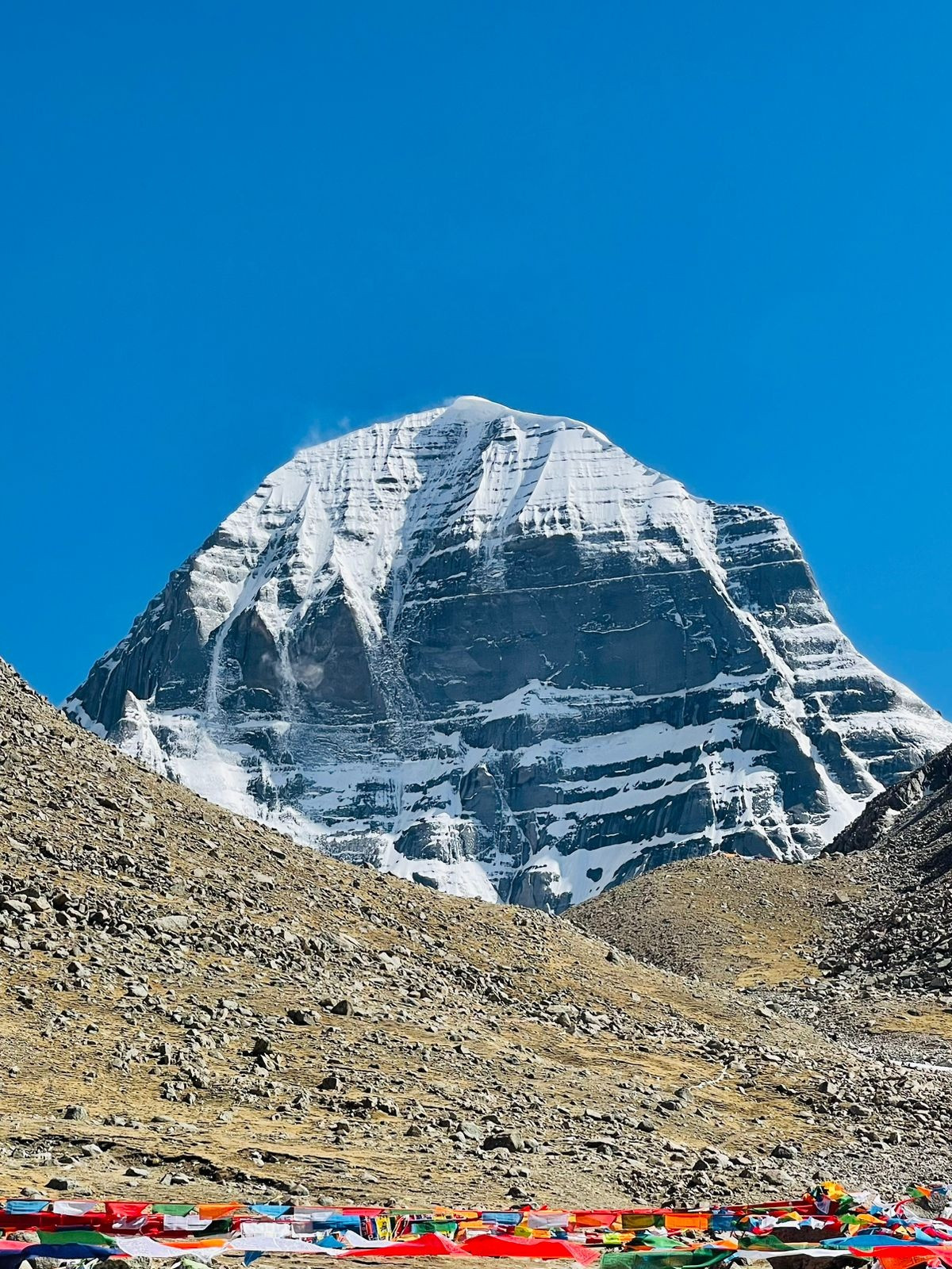
How many Kailash Mountains are there in the world? Discover the truth about Mount Kailash, its location, spiritual importance, and common misconceptions.

Classic Vacations Nepal is a Travel & Tour Company based in Kathmandu, Nepal run by a team of young and energetic travel guides experienced in adventure travel from 22 years. Classic...
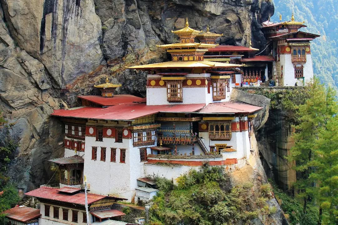
Experience the iconic Tiger's Nest Monastery hike in Bhutan. Learn about its 6.4 km round-trip distance, moderate difficulty, scenic views, and tips to complete the trek smoothly in 2025.
.png)
Everest Base Camp Trek in Nepal: Facts and FAQs about trekking tips, costs, routes, and essential information for your adventure.
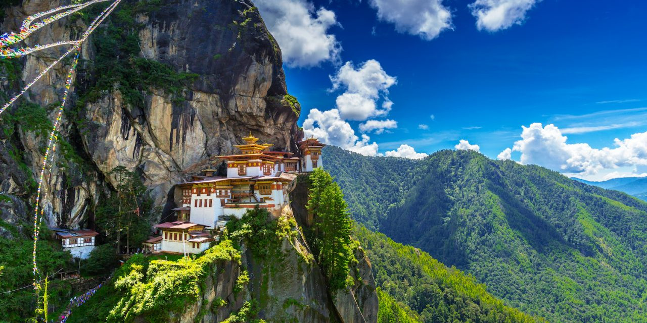
For Indian visitors, a visit to Bhutan entails a number of specific costs, where the government’s Sustainable Development Fee (SDF) forms the core. The SDF is ₹1,200 per individual,...
.jpg)
Bhutan Tour from Singapore: Step-by-step 2026 guide, flights, visa & permits, 7–10 day itinerary, must-see sights, packing tips and travel checklist for first-timers.

Fam trips in Nepal are special tours for travel agents and bloggers. They visit famous places like Kathmandu, Pokhara, and Everest Base Camp. These trips show Nepal’s culture, nature, and adv...

Kopan Monastery:
Perched on a hilltop with a view of the Kathmandu Valley, Kopan Monastery is another intriguing monastery in Nepal. The architecture of Kopan Monaster...
Travelling during the rainy season is no easy feat; the frequent change of plans, delays and the heavy rainfall add a layer of complications to your travel plans